
Built for the industries that run on infrastructure.
Drone and satellite thermography, paired with physics-aware analytics, applied to the assets that matter most — energy, buildings, environment, and critical infrastructure.

Heat loss from rooftop
Detect insulation gaps, thermal leakage, and roof performance issues across commercial portfolios.
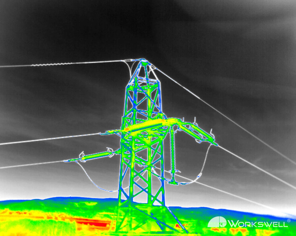
Electrical industry
Inspect substations, transformers, and power infrastructure for hotspots and failing components.
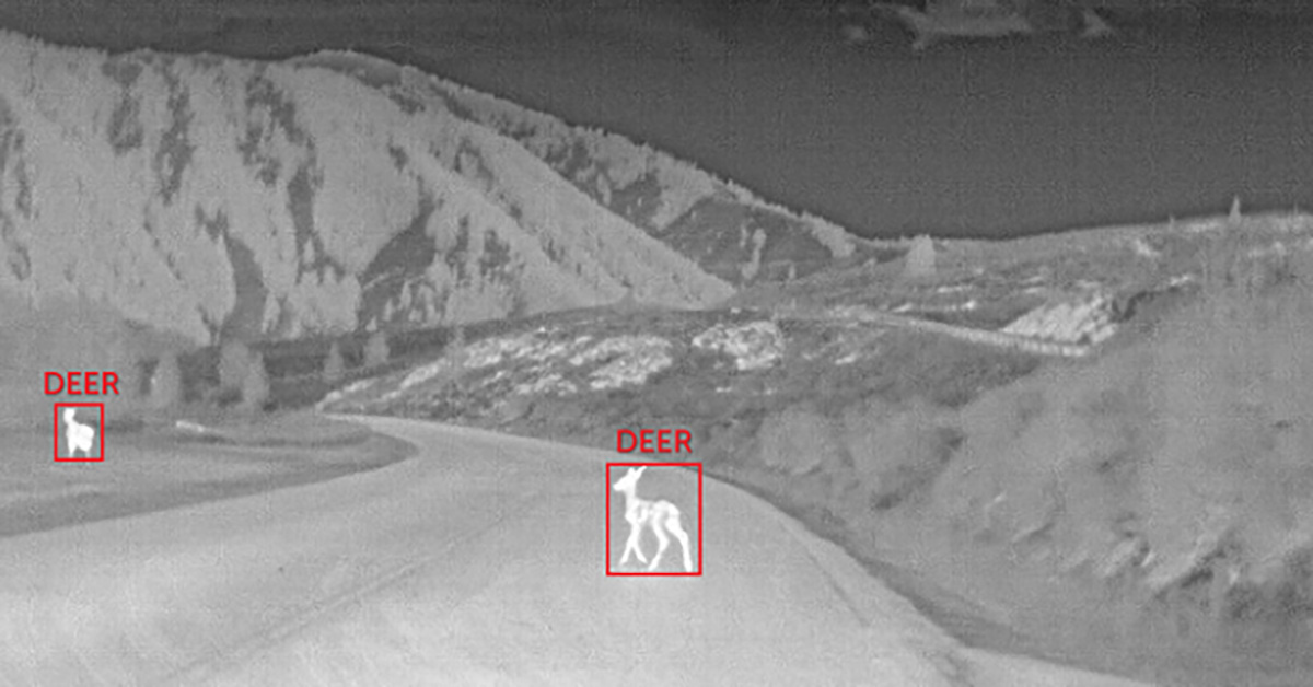
Wildlife monitoring
Thermal surveys for wildlife detection, population counts, and habitat monitoring at scale.

Agricultural fields
Identify crop stress and irrigation patterns using thermal mapping and plant-level analytics.

Groundwater discharge
Map thermal signatures revealing groundwater discharge zones and subsurface flow patterns.

Oil & gas
Flare stack integrity, tank insulation, and methane leak detection for facilities at any scale.

Solar panels
Detect hot cells, string failures, and performance losses across utility-scale PV installations.

Water bodies
Monitor surface-water temperature, mixing zones, and environmental anomalies over time.
Don't see your industry? We've probably worked on something similar.
Talk to sales →